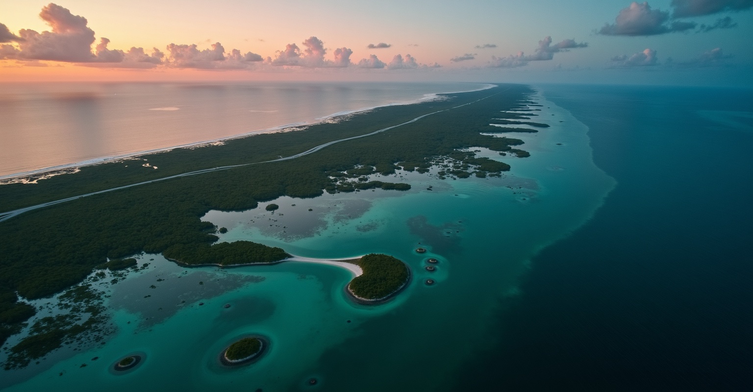
Rockstar has named six places in Leonida. Not leaked, not measured off a trailer frame. Named on Rockstar’s own site, each one with a description Rockstar wrote.
Vice City. Leonida Keys. Grassrivers. Port Gellhorn. Ambrosia. Mount Kalaga.
Most GTA 6 map pages still argue about a Panhandle and a Gulf coast and which bits of real Florida might turn up. This page did too, until I went and read the source. So this version is built the other way round. Rockstar’s six names first, with Rockstar’s own words next to each one. Then what the trailers show. Then what the community has worked out from footage.
I keep those three apart all the way down, because they are not the same kind of fact.
Where these six names come from
The official GTA 6 site at rockstargames.com/VI has a “Places” list, and rockstargames.com/VI/only-in-leonida is where the descriptions live. Six entries. Each one opens a panel with a short headline, a one-line summary, a paragraph of Rockstar’s copy and two screenshots.
One line on that page is worth reading twice before you treat the list as complete. Rockstar calls them “a few of the must-see destinations across the sunshine state.” A few. So six named places is the floor, not the ceiling. There will be more in the game that Rockstar has not put on the website.
The section header sets the frame too: “Home to the neon-soaked streets of Vice City and beyond.”
The six confirmed places at a glance
| Place | Rockstar’s headline | What it is |
|---|---|---|
| Vice City | Everything in Excess | The urban core, with named neighbourhoods and a cruise port |
| Leonida Keys | Gateway to Paradise | A tropical island chain, low-key and boozy |
| Grassrivers | Welcome to the Wetlands | Mangrove wetland, gators, airboats |
| Port Gellhorn | Live Hard | A collapsed resort town on the coast |
| Ambrosia | Keeping Leonida Sweet | Inland farming and industry, sugar refinery, biker gang |
| Mount Kalaga | Wild, Wild Country | National landmark on the state’s northern border |
Read the two ends of that table together and you get the only official statement anyone has about how far the map reaches. A mountain against the northern border. An archipelago out past the southern coast. Everything else sits between them.
Vice City
Rockstar’s one-liner: “We’re a long way from the ’80s, but Vice City is still the sun and fun capital of America.”
Then the description:
The glamour, hustle, and greed of America captured in a single city. Each neighborhood has something to offer, from the pastel art deco hotels and bright white sands of Ocean Beach, to the bustling panaderías of Little Cuba and the bootleg brands of the Tisha-Wocka flea market, out to the VC Port, the cruise ship capital of the world.
That single paragraph hands you four named parts of the city. Ocean Beach, Little Cuba, the Tisha-Wocka flea market, and the VC Port. None of those came from a leak. They are on the front of Rockstar’s site.
The two screenshots Rockstar pairs with Vice City are a couple standing on a balcony over a pool with trees and the beach behind them, and a jet flying over a sign reading Vice City.
What that tells you about the shape of the city is limited but real. Ocean Beach is the beachfront, art deco, white sand. Little Cuba is a working neighbourhood with bakeries in it, which means residential density and street life rather than towers. The VC Port is industrial and it handles cruise ships, so it needs deep water, terminals and a lot of flat space. A flea market implies an outer district where land is cheap.
Put those four together and Vice City is not one strip. It is a proper city with an economy.
What Rockstar has not published is a district list, a downtown name, or where any of this sits relative to anything else. The airport is not named on that page either, though a jet over a Vice City sign is about as strong a hint as you get without a name.
Leonida Keys
Rockstar’s one-liner: “The dress code is casual, the bars are loaded.”
Then:
Life in this tropical archipelago isn’t flashy but it’s easy.
Rockstar follows that with a warning that you are “right on the doorstep of some of the most beautiful and dangerous waters in all of America.”
So the Keys are confirmed, they are an archipelago, and the water around them matters. The two screenshots are an iguana walking in front of a mobility scooter as people pass behind it, and a seaplane over water with a bridge carrying cars between two islands in the background.
That bridge shot is the useful one. A road bridge linking islands means you can drive the chain, not just boat it. A seaplane in the same frame means air access to the islands as well.
This part of the map also has a character attached to it. Jason’s own bio on Rockstar’s site says he “found himself in the Keys doing what he knows best, working for local drug runners,” and Brian Heder is described as “a classic drug runner from the golden age of smuggling in the Keys.” So the Keys are not scenery. They are where a chunk of the story starts. More on that in the GTA 6 story breakdown and the character breakdown.
What is still unknown is how much of the chain exists. Rockstar has not said how many islands, how long the bridge run is, or whether there is a Key West equivalent at the far end.
Grassrivers
This is the one that kills the most speculation, so read Rockstar’s version rather than mine.
One-liner: “The untamable jewel of Leonida’s crown.”
You never know what lies beneath the surface of this primordial expanse. The gators may be the most famous attraction, but there are far deadlier predators and weirder discoveries among the mangroves.
Grassrivers is the wetland. Everyone has been calling it “the Everglades” for two and a half years, including me on this page. Rockstar’s name for it is Grassrivers, and that is what it should be called from here.
The name itself is doing work. “River of grass” is what the real Everglades is usually described as, so Rockstar built the analogue into the name. Mangroves get a specific mention, which is a different habitat from open sawgrass marsh. Gators are called an attraction, which suggests tourism, airboat operators and roadside businesses rather than pure wilderness.
The two screenshots are the most informative pair on the whole page. One shows three people covered in mud posing on an airboat with a dead alligator and a wildcat, one with an automatic weapon leaning against his leg and another holding a rifle. The other shows a speedboat heading toward buildings on piers, with the Vice City skyline visible in the distance.
That second shot is the closest thing to map geography Rockstar has published. The wetland and the city skyline are in the same frame. How far apart they actually are is not something a screenshot can tell you, and anybody converting that into a distance is guessing.
The airboat shot also tells you hunting is in the wetland, with real weapons, and that Rockstar is framing it as something people do rather than a cutscene.
Port Gellhorn
One-liner: “This is Leonida’s forgotten coast.”
Cheap motels, shut-down attractions, and empty strip malls won’t bring the tourists back, but there’s a new economy in this once-popular vacation spot. It’s fueled by malt liquor, painkillers, and truck stop energy drinks. Jump on a dirt bike and hold onto your wallet.
This is the region that makes the old “Panhandle” speculation pointless. A dead resort town on the coast, with an economy built on painkillers and dirt bikes, does the job that every guess about a rural northern strip was reaching for. Rockstar just named it and described it.
The screenshots are a motel at night with the vacancy sign lit, and two men in a room full of grow lights, one leaning on a shovel and one with a baseball bat over his shoulder. Motels and an indoor grow operation. That is a specific kind of place, and it is not a beach holiday.
One thing to be careful about. Rockstar says “forgotten coast” and does not say which coast. Plenty of coverage, including an earlier version of this site, has called it the Gulf side. That is an inference drawn from real Florida geography, where the quiet, faded resort towns sit on the Gulf. It is a reasonable read. It is not something Rockstar has published.
Ambrosia
One-liner: “The battle for the health and wealth of Leonida begins here.”
Rockstar’s paragraph says that “In the heart of Leonida, American industry and old school values still reign supreme,” and adds that this holds whatever the cost. Then the detail that matters:
The Allied Crystal sugar refinery provides the jobs, while the local biker gang provides almost everything else.
“In the heart of Leonida” is the phrase to hold on to. Ambrosia is inland. It is the interior region, and it has a named employer, Allied Crystal, plus a named power structure in the biker gang.
The screenshots back that up. One is the Ambrosia skyline at night with smoke stacks in the distance. The other is a motorcycle gang riding in matching leather vests down a road in Ambrosia.
A refinery with stacks means real industrial geometry, tanks, rail or truck logistics, and cane fields around it. Sugar is exactly right for the setting, because sugar cane south of Lake Okeechobee is one of the biggest industries in real inland Florida and it is politically loaded. “The battle for the health and wealth of Leonida” reads like Rockstar aiming at that.
Everything about the size of Ambrosia is unpublished. One town, several towns, a single refinery complex or a whole agricultural belt, nobody knows.
Mount Kalaga
One-liner: “Room to breathe on the state’s northern fringes.”
A national landmark up against the state’s northern border, Mount Kalaga offers prime hunting, fishing, and off-road trails. In the lush surrounding backwoods, hillbilly mystics and paranoid radicals live far from the prying eyes of the government.
Read that first clause again: “up against the state’s northern border”. It is the single most useful thing Rockstar has published about the map, and hardly anybody quotes it. It tells you where the world stops at the top.
The two screenshots are a news helicopter over a tree-filled ridge, and four people riding dirt bikes through mud with an ATV jumping behind them. Both alt descriptions on Rockstar’s site call the place Mount Kalaga National Park, which is a fuller official name than the panel headline gives.
Hunting, fishing and off-road trails are all named as activities. That is Rockstar telling you what the region is for, not just what it looks like.
Rockstar’s own Ultimate Edition copy mentions the region again, describing an off-road vehicle built for “the backwoods of Mount Kalaga and beyond.” So the backwoods are a real playable area and not just flavour text.
What is unknown is height, scale and whether the “mountain” is a mountain by any serious definition. Florida’s actual high point is 345 feet. Rockstar calls this a national landmark, not a mountain range, and it has published no elevation.
What the six names tell you about the shape of the state
Line the six up and a structure appears without anybody having to measure anything.
You have one big coastal city. You have an island chain past the southern edge. You have a wetland close enough to the city that its skyline shows up in a Grassrivers screenshot. You have a failed resort town on a coast. You have an inland industrial and farming region in the middle. You have a national landmark hard against the northern border.
That is a state with a top, a bottom, an inside and at least two coasts. GTA 5 had a city and its backcountry. This is a different kind of map.
What it is not is a layout. Nothing above tells you which coast Port Gellhorn is on, how many miles sit between Ambrosia and Vice City, or whether the drive from the Keys to Mount Kalaga takes eight minutes or thirty. Those are the numbers people want and the ones Rockstar has withheld.
Other places Rockstar has named without giving them a panel
The six regions get the spotlight, but Rockstar has quietly published a lot of other place names in its edition and pre-order descriptions on rockstargames.com/VI. Most people never scroll that far. Worth knowing that some of these come attached to Ultimate Edition content rather than being regions in their own right, so treat them as confirmed names, not as confirmed free content.
| Name | What Rockstar’s copy says about it |
|---|---|
| Ocean Beach | “world-famous,” art deco hotels, white sand, and a garage location |
| Washington Beach | Where a boat sits docked in the Ultimate Edition |
| Shore Drive | A road, referenced as the thing a ’90s sports car is an ode to |
| Shore Court | A personal garage “a stone’s throw” from Ocean Beach |
| Stockyard | A neighbourhood with a streetwear store and a tattoo parlour |
| Southside Vice City | Home turf of a gang called PTT Youngin$ |
| Little Cuba | Vice City neighbourhood with bakeries |
| Tisha-Wocka | A flea market selling bootleg brands |
| VC Port | “the cruise ship capital of the world” |
| Watson Bay | Location of the Paradise Garage |
| Gambit Bay | Named as a fishing spot |
| Lake Leonida | Home of a mod shop called One-Eyed Willie’s |
| Leonida Penitentiary | Where Lucia served time, per her own bio |
| Vercetti Estate | Where a pair of revolvers is “sourced from” |
Two of those are worth a second look.
Lake Leonida is a lake big enough to name after the state. In real Florida the equivalent is Lake Okeechobee, which sits inland, north of the Everglades and next to the sugar country. If Lake Leonida sits between Ambrosia and Grassrivers, the state’s interior makes sense. That connection is my read of the geography, not something Rockstar has drawn.
The Vercetti Estate is the other one, and it is a bigger deal than a garage. Rockstar’s pre-order copy describes revolvers with “classic Vice City stylings sourced from the Vercetti Estate,” and the weapon pattern in the Vintage Vice City Pack is described as “inspired by Tommy Vercetti’s iconic palm tree button-up.”
Rockstar also refers to Leonida as “the Goodtime State” in one edition description, which is the state’s nickname and the sort of detail that usually only shows up on in-game licence plates.
Vice City in GTA 6 is not the Vice City you played in 2002
This trips people up constantly, and the Vercetti references above make it worse rather than better.
Rockstar reuses city names across separate versions of its fictional America. The Vice City from 2002 belongs to the PS2-era continuity with Tommy Vercetti in it. GTA 6 belongs to the continuity that contains GTA 4, GTA 5 and GTA Online. Same name, rebuilt from scratch, different world.
So when Rockstar’s own store copy mentions a Vercetti Estate and Tommy’s shirt, read it as a wink and a piece of merchandise styling, not as continuity. The community reading that Tommy exists in this version of Vice City is not supported by anything Rockstar has said about its own worlds.
I go through the whole thing, with the 2009 Rockstar post that people keep misquoting, in the GTA timeline explained. If you want the feelings side of returning to the setting after two decades instead of the canon side, that is 22 years of waiting for Vice City.
Map size compared to GTA 5
Rockstar has never published a size for either map, so every figure you have seen quoted is a fan measurement. Even GTA 5’s estimates disagree with each other, running from about 29 square miles of drivable land to about 49 if you count the ocean.
What is established is that Leonida is bigger and more spread out. Six named places against GTA 5’s city-and-backcountry pair, with one of them pinned to the northern border and another out past the southern coast. Community estimates for GTA 6 range from roughly 70 square miles to well over 130, and all of them are built on trailer footage rather than anything Rockstar released.
The full version of this question, including the one official line that tells you where the map actually ends and why square mileage is a worse metric than it looks, is here: GTA 6 map size: every number you have seen is a guess.
What the trailers show that Rockstar has not named
Two trailers exist. Trailer 1 arrived December 5, 2023 and Trailer 2 on May 6, 2025. Neither shows a map, and neither puts a name on a region.
What they do show, and where it lines up with the six names:
- Airboats on shallow water with grass breaking the surface, plus alligators. That is Grassrivers.
- A beachfront strip with neon, convertibles and crowds. That is Vice City, and Ocean Beach is the obvious candidate.
- A commercial jet on an airport tarmac. Vice City has an airport. Rockstar has not named it.
- A house on stilts in the swamp. Grassrivers again, or its edge where the wetland meets dry ground.
- A marina with docked boats.
- A rural town with a gas station and pickup trucks. This is the shot people used to build the whole Panhandle theory. It fits Port Gellhorn or Ambrosia, and there is no way to tell which from the footage.
- A nightclub interior, a prison, and a strip club.
- Highways with palms and billboards.
Notice how much of that is unnamed. A marina, a nightclub, a gas station. The trailers show you places; they do not label them. Anybody telling you the gas station is in the Panhandle equivalent is filling in a blank Rockstar left empty.
The full shot-by-shot version of both trailers is in the GTA 6 trailer breakdown.
Airports and getting around
An airport is confirmed by trailer footage of a commercial jet on the tarmac, and by the Vice City screenshot of a jet flying over a city sign. In GTA 5, Los Santos International was a playable area where you could steal planes and pick up a wanted level for walking in. Expect the same job here.
Beyond that, the confirmed transport picture comes from a mix of Rockstar’s screenshots and trailer footage:
- A road bridge carrying cars between two islands in the Keys
- A seaplane over Keys water
- Speedboats, in Grassrivers and in coastal shots
- Airboats in the wetland
- Dirt bikes and an ATV in Mount Kalaga
- Motorcycles on a road in Ambrosia
- Highways connecting urban and rural areas
- A marina with docked boats
Six vehicle types across six regions, and each one is attached to a specific place. Airboats belong to the wetland. Dirt bikes belong to the backwoods and to Port Gellhorn, whose description literally tells you to jump on one. Seaplanes and boats belong to the Keys. Rockstar is matching movement to terrain rather than giving you one garage that works everywhere.
No train has been shown or mentioned. Real Florida has almost no passenger rail outside Brightline, so its absence would not be strange. GTA has used trains as mission set pieces since GTA 3 though, so I would not rule one out.
If you want a physical reference for the kind of geography Rockstar is drawing from, the Florida state road atlas is a cheap way to see how the real state’s roads, coasts and interior fit together, even though the in-game version is fictionalised.
Water is the thing to watch
Two of the six named regions are defined by water. The Keys are an archipelago that Rockstar describes as sitting on the doorstep of “the most beautiful and dangerous waters in all of America.” Grassrivers is a wetland whose whole pitch is what is under the surface.
No GTA has committed to water on that scale before. GTA 3 and the 2002 Vice City used water as a wall you drowned in. San Andreas let you swim. GTA 5 added scuba, submarines and a detailed sea floor, then gave you very little reason to go down there.
Here the water has content attached to it in Rockstar’s own copy. Fishing is named at Mount Kalaga and at Gambit Bay. A boat comes with an explosives crate in the Ultimate Edition. Rockstar’s Grassrivers line about “far deadlier predators and weirder discoveries” is a promise about what is in the water, not about how it looks.
The open question is whether swimming and diving are real systems or fallbacks. Rockstar has not said.
What six regions could mean for how it plays
Each named region comes with its own activity set in Rockstar’s copy, which is a change from how GTA maps usually get described.
Vice City is the classic GTA space. Dense streets, traffic to weave through, buildings, crowds, police pursuits. Ocean Beach, Little Cuba, Stockyard and the port all suggest different driving and different NPC behaviour in each.
Grassrivers is the part GTA has never had. Airboats through narrow channels. Tall grass to hide in. Animals that can actually kill you. Rockstar’s own hunting screenshot suggests wildlife is a system, not decoration. In GTA 5 the deer and cougars in Blaine County were basically props.
The Keys give you island hopping, long bridge runs over open water, and boats as transport rather than novelty.
Port Gellhorn is a decaying town, which usually means cheap property, empty buildings you can use, dirt bike terrain and low-level crime. Rockstar’s grow-lights screenshot points straight at that.
Ambrosia is industry and agriculture with a biker gang on top. Refineries, open roads, cane fields, and a faction. That is territory work, not tourism.
Mount Kalaga is hunting, fishing and off-road trails, in backwoods that Rockstar says are populated by “hillbilly mystics and paranoid radicals.” Remote, weird, and probably where the strangest side content lives.
The thing that decides whether any of this lands is density. A named region with nothing in it is scenery you drive through. Six named regions with real activity in each is the biggest open world Rockstar has built. Nobody can call that from the outside yet.
Fast travel in a state this spread out
Rockstar has published a northern border with a landmark against it and an island chain past the southern coast. Whatever the actual mileage is, the drive from one to the other is long.
Rockstar has historically resisted menu-based fast travel in GTA. GTA 5 let you call a taxi or a helicopter pickup and left it there. Red Dead Redemption 2 went further with coaches, trains and camp travel, and still kept it grounded in the world.
For GTA 6, the pieces Rockstar has already shown suggest in-world options rather than a teleport menu:
- Taxis or a rideshare app on the in-game phone
- Air travel from the Vice City airport
- Seaplanes and boats for the Keys, which Rockstar has already put on screen
- Highways that are genuinely faster than city streets
That is a guess about design, not a leak. Rockstar has confirmed nothing about fast travel.
My read is that they will keep it in-world. Call a ride, take a plane, get a lift from the other protagonist. It fits how they have handled every map since GTA 4, and it keeps the distance meaningful instead of erasing it.
How Leonida’s regions compare to GTA 5’s
GTA 5 had four distinct areas and it is worth putting them next to the six.
Los Santos was the urban core, with real neighbourhood variety inside it: Vinewood, Rockford Hills, South Los Santos, Vespucci Beach, downtown. Vice City is the equivalent, and Rockstar has already named four of its parts.
Blaine County was the rural region: Sandy Shores, Grapeseed, desert and forest, with hunting, off-roading and airstrips. Leonida splits that job across three named regions instead of one. Port Gellhorn is the decayed coastal town, Ambrosia is the agricultural and industrial interior, Mount Kalaga is the backwoods. Three different flavours of “not the city” where GTA 5 had one.
The Alamo Sea was a dead lake in the desert. Atmospheric, mostly empty. Grassrivers is the closest thing structurally, and Rockstar’s description points the opposite direction: gators as an attraction, deadlier things in the mangroves, discoveries under the surface. That reads like a region with content in it, which the Alamo Sea never had.
Mount Chiliad was GTA 5’s landmark peak at the north end of the map. Mount Kalaga is the direct equivalent, on the northern border, with off-road trails around it. Same job, opposite corner of the country.
GTA 5 had no island chain. Leonida does.
The whole comparison across everything else, not just the map, is in GTA 6 vs GTA 5.
What the community has inferred, and why I am labelling it
The mapping effort that has been running since Trailer 1 dropped in December 2023 is serious work. People have gone frame by frame through both trailers, matched skyline shots against real Miami geography, measured against visible landmarks and cross-referenced Rockstar’s materials.
It is worth reading. It is also inference, and it should be flagged as inference every time. Here is what it currently holds, all of it unconfirmed:
- Vice City sits on the eastern coast, matching Miami’s real position
- The wetland lies west or south of the city, matching the real Everglades
- The airport appears to be west of the city
- A major interstate runs through or around the city and out to rural areas
- Significant waterfront on at least one side of the map
Rockstar’s six names have already overwritten a big chunk of what the same effort used to hold. For two and a half years the standard version of this article, including mine, talked about a Panhandle equivalent, a Gulf coast region and a central Florida theme park corridor. Rockstar published Port Gellhorn, Ambrosia and Mount Kalaga, and none of those guesses were needed any more.
There is a lesson in that. Community mapping is good at working out what sits next to what. It is bad at names, borders and distances, because trailers do not contain that information.
The interactive map at launch
Rockstar has not confirmed an interactive map for GTA 6. I would still bet on one.
GTA 5 had an interactive map on the Social Club site for tracking collectibles, activities and points of interest, and GTA Online added an in-game version with custom markers. A state with six named regions in it needs that more than Los Santos did.
Expect something more capable than GTA 5’s, probably tied to the Rockstar Games app. That is a prediction, not a confirmation.
What is still unknown about the map
The honest list, after all of the above:
- The map size in square miles. Never published, and see the size page for why the number you have read is somebody’s guess.
- How big each of the six regions is next to the others.
- How much of the Leonida Keys chain is modelled, and whether there is a far-end island.
- Which coast Port Gellhorn is on.
- How high Mount Kalaga is.
- Whether there are named places between the six, and how many.
- How fast travel works, if it exists.
- Whether there is a train.
- How many interiors you can walk into.
- Whether the map grows after launch, the way GTA Online’s did.
- The install size, which Rockstar has never published either.
What is locked in: November 19, 2026, on PS5 and Xbox Series X|S only, single-player at launch, with digital preload opening November 12. Standard is $79.99 and Ultimate is $99.99, two digital editions, no Collector’s Edition. Jason Duval and Lucia Caminos are the protagonists, and Rockstar’s own synopsis puts them in “a criminal conspiracy stretching across the state of Leonida.”
What I actually expect
Six named regions, from a mountain on the northern border to an island chain past the southern coast, with a city, a wetland, a dead resort town and a sugar-and-bikers interior in between. Water that matters more than it ever has in this series, because two of the six are defined by it. Movement matched to terrain rather than one vehicle set for the whole map.
No square mileage from me, because Rockstar has not given one and neither has anybody else who is being straight with you.
The next real update on any of this will come from Rockstar, not from a frame count. When it does, this page changes the same day.